October 06, 2022
With a new grant from NASA, LSU scientists will track the impact of severe weather disturbances on the coastal wetlands and estuaries in Louisiana and Texas.

Examining a diverse array of ecosystems ensures researchers will get a systemic picture of how coastal ecosystems respond to extreme weather events and other disturbances.
– Z. George Xue
BATON ROUGE – A diverse array of ecosystems exist along the shores and in the waters of the Gulf of Mexico, many of them well-documented by researchers. However, in the face of increased severe weather and the stressors brought on by climate change, it is becoming clear that more work needs to be done to understand how the Gulf functions as a single system.
Now, a new 3-year, $1.4 million grant from NASA will allow LSU researchers to embark on gaining a more holistic view of the western portion of the Gulf, in part by deploying a novel computer modeling approach, called coupled modeling.
Z. George Xue, an associate professor in LSU’s Department of Oceanography & Coastal Sciences, or DOCS, with a joint appointment at the Center for Computation and Technology, will be heading a research team that includes DOCS Associate Chair and Professor of Oceanography & Coastal Sciences Kanchan Maiti, as well as Xinping Hu of Texas A&M Corpus Christi and David Lagomasino of East Carolina University.
The scientists aim to paint the fullest picture yet of how coastal wetlands and estuaries in the western Gulf of Mexico are responding to the pressure of increasing severe, transient disturbances, such as hurricanes, tropical storms, and even inland flooding. Their research will focus on ecosystem resistance—an individual area’s ability to withstand disturbances--and resilience--how well it recovers after damage has occurred.
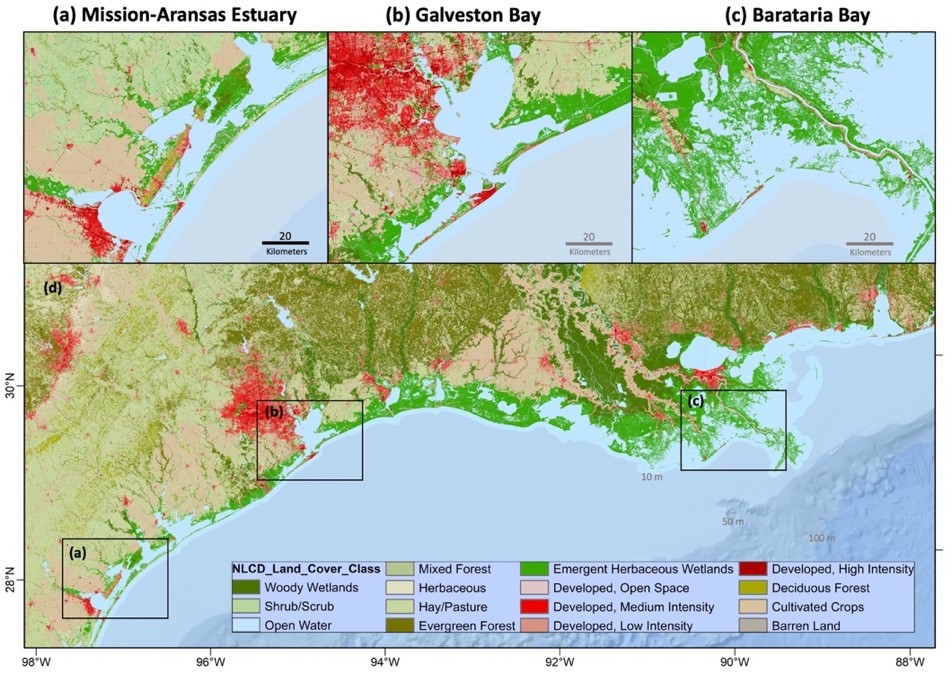
The project spans three very different sites. Researchers will work in the grasslands and wetlands of Louisiana’s Barataria Bay, the Texas coast’s more urbanized Galveston Bay and finally, Mission-Aransas Estuary, also off the coast of Texas and known for its aridity. Examining such a diverse array of ecosystems ensures they will get a systemic picture of how coastal ecosystems respond to extreme weather events and other disturbances.
Coupled Land-Ocean Modeling: A Novel Approach
One of the central tasks of this project will be the further development of a novel coupled ocean hydrological model, an ambitious undertaking that Xue says may be among the first of its kind. Computer models of two separate systems—in this case, river water and other runoff from land, and ocean water—are paired and run at the same time, effectively allowing them to interact with each other just as systems in the natural world would. This coupling replicates the kinds of feedback that occurs between systems and results in a more accurate depiction of coastal processes, such as compound flooding.
It’s an approach Xue has used before. The model will be built on top the models created for a previous EPSCoR project co-funded by NASA and the Louisiana Board of Regents, to study carbon export from in the Mississippi Delta. These intensive modeling techniques demand so processing power, they not only have to be run on Louisiana’s High Performance Computing Facility, the state’s only supercomputer, but they have made Xue’s group the largest user of the facility in the state. His hope is to eventually build similar models for the rest of the Gulf of Mexico.
“By applying and further developing the state-of-the-art compound flooding model, this project will significantly boost our understanding of the land-ocean interaction during extreme weather events like hurricanes and floods. The knowledge and technology gained from this project will benefit not only coastal Louisiana and Texas but also are transferable to other locations that are prone to coastal natural disasters,” Xue said.
